Map Settings

- Select the Settings icon located on the Map toolbar.
- Choose each tab to customize.
Filters
Enable filters to specify which tanks display when scheduling tanks for delivery.

- Show auto-fill tanks which are between – Display auto-fill tanks with an estimated percent left within the chosen range.
- Show Julian deliveries due within the next – Display Julian deliveries that have a next scheduled date within the amount of days from today that is entered.
- Mark julians critical if they are at least – This will modify the symbol of Julian deliveries to display with a bold border to indicate past due.
- Show tanks with zero gallons to deliver – Display tanks where the estimated gallons to deliver is 0.00.
- Show call-in tanks with no active entry – Display Call In Delivery Type tanks that do not currently have an active Call In assigned.
- Show tanks that are on hold – Display tanks that are actively on hold.
GPS
GPS Settings are not actively used at this time.

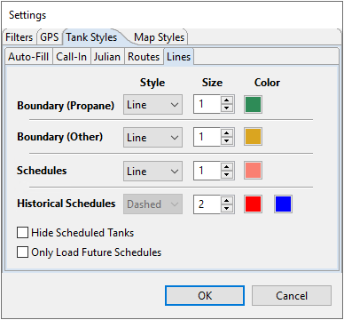
Tank Styles
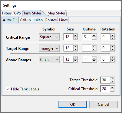
- Auto-Fill – Modify the Symbol, Size, Outline, and Rotation for Critical, Target, and Above Ranges. This also allows the modification of Target and Critical Thresholds for these tanks.
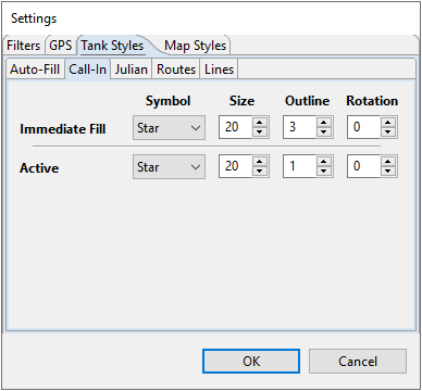
- Call-In – Modify the Symbol, Size, Outline, and Rotation for the Immediate Fill or Active Call Ins that show up on the map.
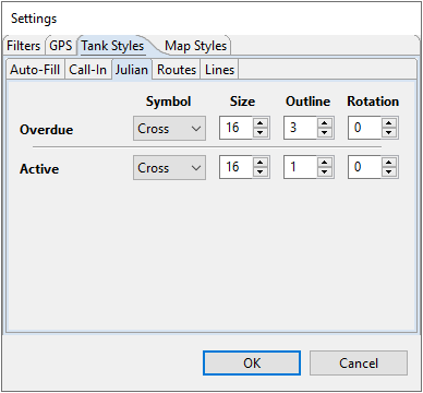
- Julian – Modify the Symbol, Size, Outline, and Rotation for the Overdue and Active Julian deliveries.
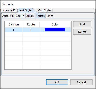
- Routes – Modify the color of the tanks for each route.
- Lines – Modify the thickness and color of the Boundary lines and the lines denoting scheduled deliveries.


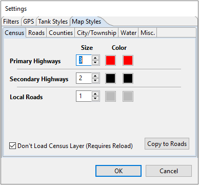
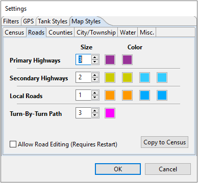
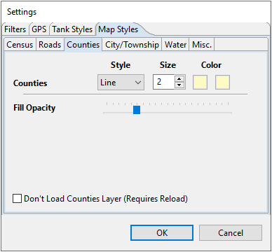
Road Styles
- Census – Determine the Size (width and weight) of Primary Highways, Secondary Highways, and Local Roads. Census roads are considered read-only and cannot be modified.
- Roads – Roads have the same functionality as Census Road layers but can be modified to add/remove roads and can display the path from one tank to another.
- Counties – Modify the thickness and color of the County lines.
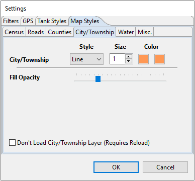
- City/Township – Modify the thickness and color of the City/Township lines.
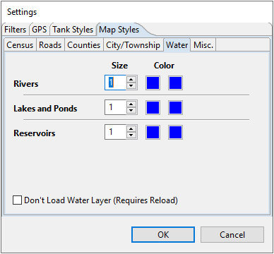
- Water – Modify the thickness and color of boundary lines for any Rivers, Lakes and Ponds, or Reservoirs on the map.
- Misc. –Optionally make a selection for the Map Pane Background Color.


